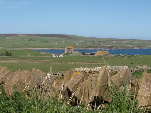
It’s holiday time again. After tackling the Broads last year, we figured it was time to go back to the canals. With only three of us, we thought it prudent to try to find a route that wouldn’t have too many locks on it, so the Llangollen canal looked perfect. It also has the added lure of the Pontcysyllte Aqueduct, another masterpiece by Thomas Telford. Something we hadn’t thought about, of course, was that every year, at the beginning of July, Llangollen is the site of the Eisteddfod… quite what this would mean in terms of moorings and how busy the canals would be, we would have to see. It always helps to have more than one plan…
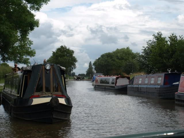
4 July: Bunbury to Hurleston Junction. Having picked up the boat (almost identical to the one we had two years ago), the first thing was to turn it round. First find your winding hole… (it’s pronounced ‘wind as in weather’, rather than ‘wind as in wrap up’) At this point, the rain starts. After a few close encounters of the branchy, leafy kind, we manage a several point turn, and head back past the boatyard to Bunbury staircase lock. This is the first one we’ve done that is wide enough for two boats; always an advantage if you can find another boat to accompany you – more people to work the locks! The weather improved, and it’s a short trip today, being late afternoon already, so we chug along down the Shropshire Union canal at between 3 and 4 miles an hour to a overnight stop at Hurleston Junction, just below the first flight of locks on the Llangollen canal.
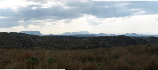
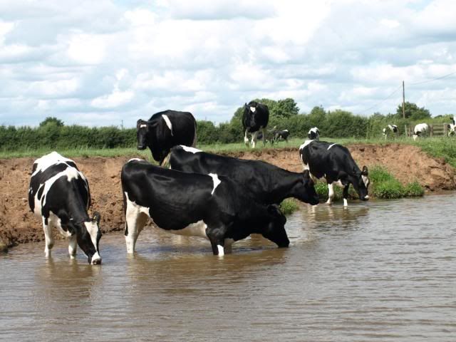
5 July: Hurleston Junction to Willey Moor Lock. So the first thing we were faced with in the morning was a set of very narrow locks (Drew had been to investigate last night, and reported one boat that tried several times but eventually gave up!) and Mum’s first go at wielding the lock handle. Up we go, because from here it’s climbing all the way to Wales. The canal is fed by the River Dee, so there is quite a strong flow of water, which tends to push the boat around a bit; fortunately it’s a gently meandering route across the Cheshire plain, between herds of cows, who take a vague interest as we pass.
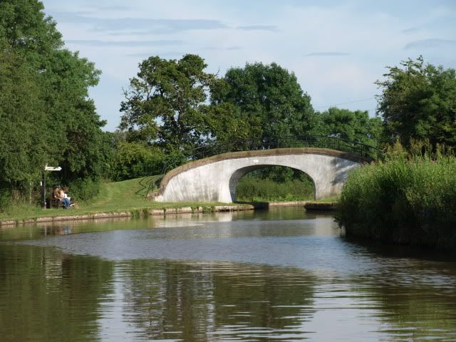
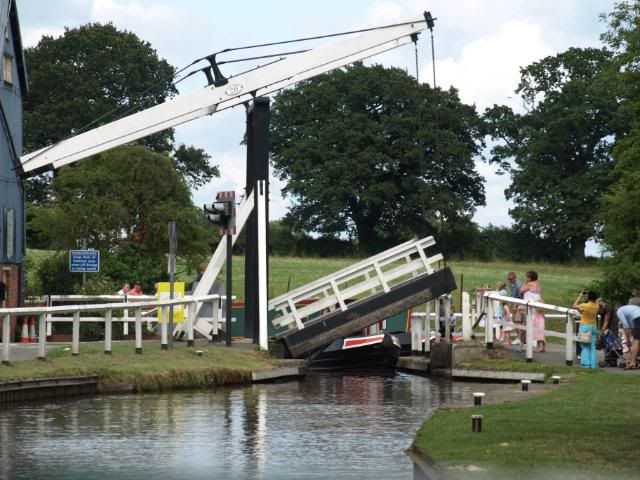
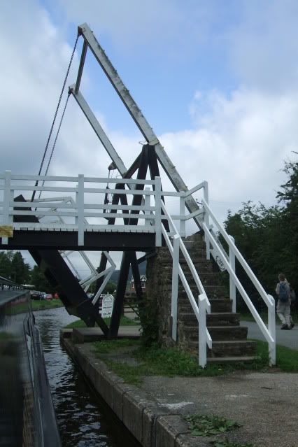
It’s pretty quiet, with a few locks, and the real excitement comes at Wrenbury, where we meet our first lift bridge. These require winding up for the boat to pass, and then one has to retrieve the crew member who must wind the bridge back down to cross and rejoin the boat. Even more exciting is the bridge in the middle of Wrenbury, which carries the main road. First, stop the traffic! It’s controlled by lights, like a level crossing; fortunately it’s also electrically powered. It’s quite a sharp turn round the corner, but I manage it without my usual pinball approach to locks and other narrow things!
There are more lift bridges to follow, though these are hand-wound, and we hopscotch along sharing the work with another boat. Tonight’s mooring is at the pub beside Willey Moor Lock, which also provides a convenient place for dinner and a pint or two.
6 July: Willey Moor Lock to Hindford. We start the day with another interesting set of locks – the Grindley Brook flight and staircase. Fortunately, there is a cheeky lock-keeper to assist and co-ordinate the boats going up and down, and we get through without incident. It’s a pretty place, and I would have taken pictures, but I was a little occupied with boat-handling. We moor up at the top of the locks to water up and have coffee, before heading onward.
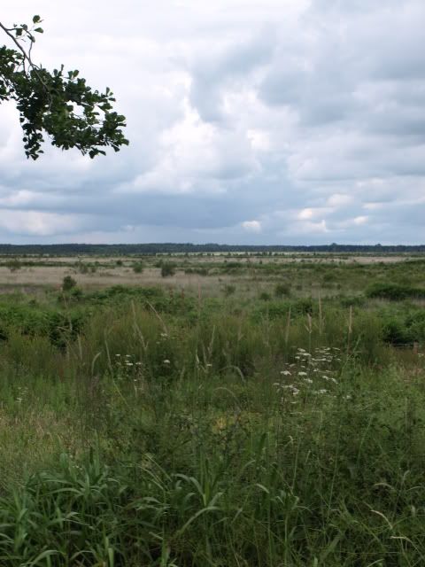
There are more lift bridges to come as we pass Whitchurch, and start out across one of the largest lowland raised bogs in Britain, the Fenn’s, Whixall and Bettisfield Mosses National Nature Reserve, and we cross and re-cross the border between England and Wales several times.
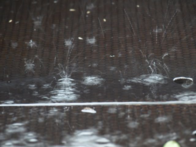
As we approach Ellesmere, the weather decides there is not enough water around already, and it begins to pour with rain. Leaving Drew to steer, Mum and I take refuge in the cabin and peer out at the passing greenery.
There’s still plenty of daylight, and after Ellesmere, we pass through more peaceful rural scenery, slowly drying out as the sun comes back. We pass the entrance to the Montgomery Canal at Frankton; we thought about going up there, but it requires booking to pass through the locks at a particular time, and we’re seldom that organised. Add to that a comment from another boater that midge numbers were astronomical in the upper reaches, and we figured it was one to miss. Mooring was at Hindford, not far from the Jack Mytton pub.
7 July: Hindford to Llangollen. Only two locks today, and then there are no more until we meet these coming back. That’s not to say there are no interesting features today! There are lift bridges, tunnels, narrowings, busy boatyards and delinquent dayboats ahead, not to mention two aqueducts…
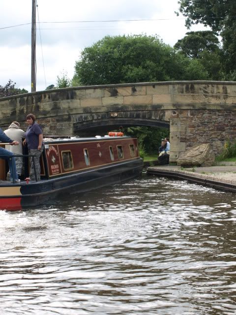
First there is Chirk Aqueduct.
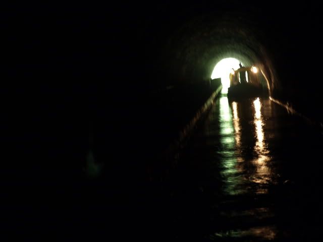
This has a wide stone cladding, and runs beside the railway bridge, and goes almost immediately into the Chirk Tunnel. We emerge from the dark into a deep cutting, which leads into Whitehouse Tunnel.
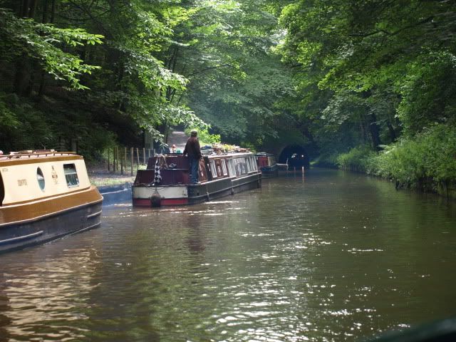
Before the Big One – the Pontcysyllte itself – we have to navigate narrows before the village of Froncysyllte, where moored Waterways Board boats make things even tighter. Fron also has a lift bridge, and a lot of folks watching to see the boats go by.
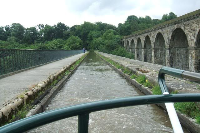
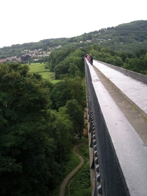
Now comes the hairy bit… unlike the aqueduct at Chirk, Telford’s masterpiece has no stone cladding. The canal crosses the valley in a lead lined iron trough, and it feels a little like we are hanging in the sky. It is, of course, a difficult thing to take photos of. You’re on it, and there are very few ‘long’ views as you approach. It’s an astonishing thing. Eighteen stone piers hold up a thousand feet of waterway, up to 127 feet in the air. You have to cross in convoy, because once you’re on, there’s no going back.
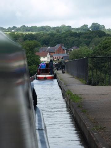
We moor up at Trevor, so Drew can go back and take some more photos, and to look for postcards. While we wait to head up the last, narrow bit of the canal to Llangollen, we watch the antics of the dayboats. They don’t seem to recognised that it takes time to manoeuvre a narrowboat, and they don’t go backwards with any ease or grace; as a consequence there is often a little conflict when the space gets tight. Like going under a bridge on a corner…..
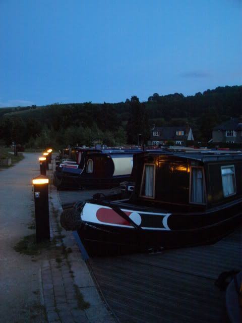
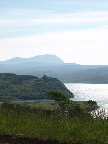
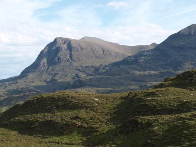
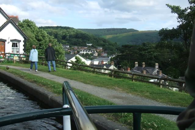
The canal runs halfway up the valley side, with glorious views away across to the Welsh mountains. It’s green and lush, with overhanging trees, and as we approach Llangollen, it gets narrower, with one-way working at some places, where the canal has been cut into the rockface. It’s busy, with a lot of boats strung out along the canalside moorings. There are a couple of places left in the marina, though, so we pay our mooring fee and pass the middle of the town, the slate rooftops below us.
We moor up, not without incident; the boat is heading beautifully towards the pontoon when a sudden gust of wind hits the slab side of it, and shoves us irresistibly into the side of another moored boat. No damage to either, and apologies seem to suffice. The Eisteddfod ground is only a couple of hundred yards away across the canal, and we have dinner listening to Barbara Dickson in concert. A fine evening, and a free gig… I’m not complaining! And it’s my birthday!